Showing posts with label Walking Track. Show all posts
Showing posts with label Walking Track. Show all posts
Thursday, September 5, 2024
Brompton Ride & Hike to Mt. Tohnodake 1491m
In order to escape from terrible heatwave in summer, I tend to go anywhere well beyond 1000m in its elevation in the past weeks. Today's destination, Mt. Tohnodake, is located in Tanzawa Mountains and popular for its spectacular view with Mt. Fuji and other high mountains around it.

Sunday, December 17, 2023
Brompton Ride and Hike to the top of Mt. Mihara, huge, active volcano near Tokyo.
Brompton hill climbing ride to the trailhead and, leaving Brompton there, trekking walk to the top of Mt. Mihara, one of the world's largest active volcano which locates on Oshima Island only 100 km from central Tokyo.
When I reached the top just beside the huge crater, the view was spectacular and solemn. It was a fantastically fine day, no cloud, no wind at all, and exceptionally warm in Winter. I was lucky. Mt. Fuji was seen from the top of the island.
It was difinetely the best RIDE & HIKE ever for me and my Brompton.
Saturday, April 29, 2017
Wilsons Promontory 2nd day. Let's go to South Point.
(previous article: Wilsons Promontory 1st day)
When I waked up in Lighthouse accommodation on the second day, it was lovely weather with blue sky.
At 8 o'clock in the morning, we assembled to climb the lighthouse up.




I left the lighthouse around 8:30. South Point was 8.7 km away from here. I hurried there via Roaring Meg.





Finally arriving in Tidal River camping ground. It took about 7 hours including break time.

When I waked up in Lighthouse accommodation on the second day, it was lovely weather with blue sky.
At 8 o'clock in the morning, we assembled to climb the lighthouse up.

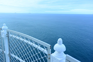
Though the tower was only 19 meters high, a 90-meter elevation of the cliff contributes to its focal height of 117 meters. The participants of the lighthouse tour enjoyed the 360-degree view from the top.


I left the lighthouse around 8:30. South Point was 8.7 km away from here. I hurried there via Roaring Meg.

In the middle of the way, I took the walking track to Roaring Meg instead of vehicle track which I walked yesterday.

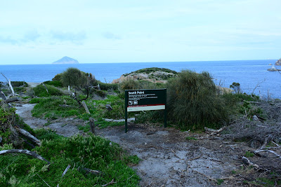
2 hours later I arrived at South Point. There is nothing special or remarkable here, but it is truly the southmost point of Australian Continent and it seems very popular place for Australian people. I met a lot of people on the way to South Point and back to Roaring Meg.


Once getting back to Roaring Meg, I departed for Telegraph junction.
I took a different way back to Tidal River as I wanted to see beautiful beaches of Oberon Bay and Little Oberon.

Oberon bay has a longer-than-5 km beach line. What a beautiful beach it is!

Looking over Oberon Bay from the trail.

A lot of couples and families enjoyed Proms walking.

Little Oberon is located over a small cape from Oberon Bay. It is secluded and beautiful!


Though I was tired a little, it was a wonderful journey to one of the extreme point.
(end)
Friday, April 28, 2017
Wilsons Promontory 1st Day. A road to that Lighthouse.
Have you ever been to South Point?
South Point is the southernmost point of the Australian mainland. It lies at the tip of Wilsons Promontory in the state of Victoria and is a part of Wilsons Promontory National Park.

On a lovely summer day, I happened to find a vacancy at that lighthouse accommodation of the Wilsons promontory. I suddenly decided to go to Proms for South Point.

When I arrived with my Brompton at Telegraph Saddle where one of the trail entrances to South Point and the lighthouse is located, I found that it is a bike-off-limit trail.

Leaving my Brompton at the parking of Telegraph Saddle, I started a track walk toward the lighthouse where I was luckily able to make a reservation.


Looking back to Telegraph Saddle where I started to walk an hour ago.

After going over a ridge, I arrived at Roaring Meg. I had another 6.9 km to the lighthouse.

After another ridge to go over, I reached the cliff side track to look over a shining white small island in the sea.

Finally reaching the lighthouse on one of the edges of Proms.

Last slope to the lighthouse was really heart-breaking.

Accommodation was more than expected!


In 1859 the Wilsons Promontory Lighthouse was built on a 90-meter cliff on the point. The tower itself is only 19 meter high. Though quite a few the lighthouses, including Cape Otway Lighthouse, become not in use now, the Wilsons Lighthouse is still active and protects shipping travelling through Bass Strait.

Tomorrow I will visit South Point, the southmost point of Australian continent.
(To be continued)
South Point is the southernmost point of the Australian mainland. It lies at the tip of Wilsons Promontory in the state of Victoria and is a part of Wilsons Promontory National Park.

On a lovely summer day, I happened to find a vacancy at that lighthouse accommodation of the Wilsons promontory. I suddenly decided to go to Proms for South Point.


Leaving my Brompton at the parking of Telegraph Saddle, I started a track walk toward the lighthouse where I was luckily able to make a reservation.

1st day. 19 km trail walk from Telegraph Saddle to Lighthouse via Roaring Meg.
Looking back to Telegraph Saddle where I started to walk an hour ago.

After going over a ridge, I arrived at Roaring Meg. I had another 6.9 km to the lighthouse.

After another ridge to go over, I reached the cliff side track to look over a shining white small island in the sea.


Last slope to the lighthouse was really heart-breaking.

Accommodation was more than expected!

Encountering a wombat at first time.

In 1859 the Wilsons Promontory Lighthouse was built on a 90-meter cliff on the point. The tower itself is only 19 meter high. Though quite a few the lighthouses, including Cape Otway Lighthouse, become not in use now, the Wilsons Lighthouse is still active and protects shipping travelling through Bass Strait.

(To be continued)
Subscribe to:
Posts (Atom)