Monday, October 26, 2015

Mont Éventail, Another Paradise of Trail Ride

Yesterday Brompton and I went to climb Mont Éventail (Mt. Ougiyama), which has 1,312m of its elevation and is another popular destination of trekking and off-road biking near Tokyo. I wanted to climb another mountain to watch Mt. Fuji again. In addition, I love to enjoy a trail ride.

Take JR Chuo Line as well to get to Saruhashi Station or Otsuki Station. Then you get on the bus bound for Asakawa bus stop, an trail head to Mont Éventail.


[Data]

Route Asakawa bus stop (elevation 628m) → the ridge → Mont Éventail Summit (elevation 1,138m) → the trail on the ridge → Inume Village → JR Torisawa Station
Distance 13.8km
Max. Difference of Elevation 836m
Average % total -2.3% ascent 12.1% descent 12.3%
Acquired Elevation ascent 609m descent 920m


https://www.google.com/maps/d/edit?mid=zVh_vanqLQwc.ka3JwwNZc6ms&usp=sharing

You can see Mont Éventail (Mt. Ougiyama) from a train window.

From JR Otsuki Station, take a bus (Yamanashi Fujikyu Bus Company) bound for Asakawa bus stop.

Let's unfold your bike at Asakawa bus stop and take a ride to the trail head.


After 1 km ride, you arrive at the trail head and start to pull Brompton to the ridge for another 1 km up there.

Upon arrival at Asakawa pass, please proceed to Mont Éventail (Ogiyama).

The trail is not that hilly. You can partly ride on Brompton.

From the peak Mt. Fuji was wonderful.


Then start a comfortable downhill on the ridge trail. You can go this single track covered by a lot of autumn leaves.


Watch ahead! There are sometimes tree roots and fallen trees on the trail.

I supposed that the trail was best ever for me and Brompton. Slopes were moderate and there were few stones and rocks on the track. 


Even autumn tints pleased my eyes on the way.

I took a short rest at the view point on the way downhill.


After the view point the trail increases the gradient of a slope.

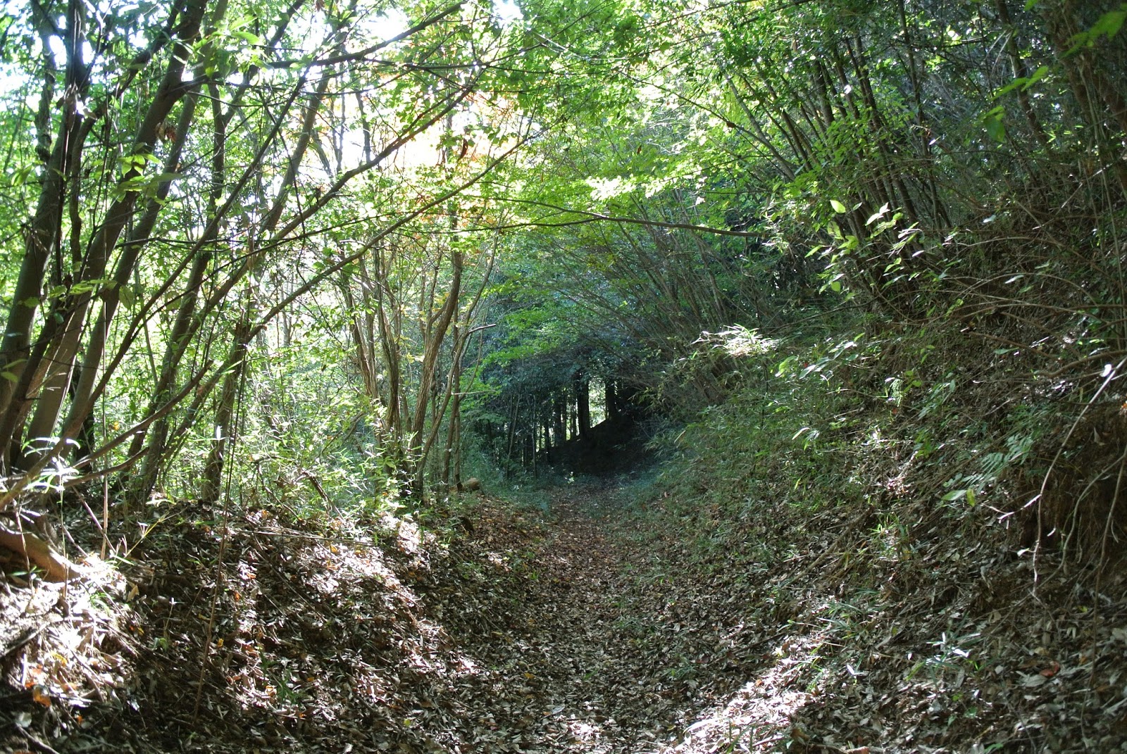
It looks a straight descent in a green tunnel!

Arriving in Inume Village and exit the trail.

Inume is famous for one of Hokusai's masterpieces "Fuji from Inume Pass."

Mt. Fuji from Inume Pass, one of the 36 views of Mt. Fuji by Hokusai Katsushika.

In order to go home, take a train bound for Tokyo at JR Torisawa Station.

Tuesday, October 20, 2015

Mount Gongen, A Paradise of Trail Ride

I heard that Mt. Fuji got a first snow fall on its top. Mt. Fuji is most beautiful when the top is covered with a snow cap.

Let's climb a neighboring high mountain to see beautifully snow-crowned Mt. Fuji in a short distance. Last weekend, Brompton and I went to climb Mt. Gongen, a popular destination of trekking and off-road biking near Tokyo.

Take JR Chuo Line to get to Uenohara Station. Then you get on the bus bound for the trail entrance.

[Data]
Route Yotake bus stop (elevation 293m) → the ridge → Gongenyama Summit (elevation 1,312m) → Wami Forest Road → JR Uenohara Station
Distance 24km
Max. Difference of Elevation 1,132m
Average % total -0.6% ascent 11.9% descent 8.7%
Acquired Elevation ascent 1,052m descent 1,191m


https://www.google.com/maps/d/edit?mid=zVh_vanqLQwc.kyti90EYpHg0&usp=sharing


When I arrived at Yotake bus stop, unfolded the bike to start.

5 minutes later the paved road ended and the trail started. The first part of the trail was unexpectedly steep until it reached the ridge.

After getting to the ridge of about 500 meters in elevation, the trail becomes relatively flat and you can enjoy trail rides on your Brompton.


When I further traversed the ridges of Mt. Gongen,  suddenly met a group of 10 MTB riders on the trail.

The group included a foreign traveler from Europe or the US. He said "It's wonderful and exciting!"

Continuing riding on the ridge trail toward the peak of Mount Gongen.

A microwave tower was on the way. The ridge trail still continued.

Approaching the peak area.

On a short way to the peak, there was a old, modest shrine.

It is the inner sanctuary of Osero Shrine dedicated to Yamato Takeruno Mikoto, a legendary hero in the Japanese mythology. Ancient documents said that the shrine already existed in the Bunka Years of the Edo Period, between 1804 and 1818.

Autumn tints beautifully decorated around the top of Mount Gongen.


Finally I reached the peak of Mount Gongen with its elevation of 1,312 meters.


This is Mount Fuji with a snow cap. Wonderful!

Thursday, October 15, 2015

Kamikochi - Great Old Route Via Tokugo Pass #3

Previous number:

Let's go to a mountain trail together with your Brompton. 

Brompton and I continued to trace the grand old trail, going downhill along the Shimashima Valley river. I found a beautiful waterfall at Iwanadome. 

The grand old trail was quite beautiful though a little tricky. 

A couple of ladders on the way.

Some bridges over the streams were scary to go across with Brompton.

This bridge was not for use.

However, a part of the trail was a fantastic single track.

Brompton and I passed by the Shimashimatani canyon along the river. There was a wooden plank road beside the cliff.

Winds blew between trees and cliffs.

Watch your step carefully when you go through a part of the trail covered by gravel of landslide.

Sometimes the trail goes very high from the river level.

Arriving at the mid-point between the Tokugo pass and Shimashima. But...., Shimashima was still very far, 8.9 km away from this point.

There was a fresh landslide. Be aware of falling rocks and your steps.

We were finally approaching the end of the trail.

The trail ends here.

Brompton and I proceeded another 6 km on the unpaved but flat road toward Shimashima. It was an easy ride if compared with the trail.

Arriving in the junction of Shimashima Village to join Route 158 which connects Matsumoto and Takayama.

From the junction, we soon arrived at Shin-Shimashima Station to catch the train bound for Matsumoto Station.

At Matsumoto Station, changing to JR to have a sheet on Azusa Super Express bound for Shinjuku.


I was able to have dinner at home. What a wonderful day it was! Do you want to experience such a fantastic trail ride? Let's go there with me next season if you love to.