Saturday, May 28, 2016

Mt Donna Buang

Brompton and I went to the peak of Mt Donna Buang with an elevation of 1,250 meters above sea level.


[data]
Distance: uphill 17km, downhill 17km
Acquired elevation: 1106 m
Average % of slope: 6.5%


Early in the morning Lilydale Station was covered with thick fog.

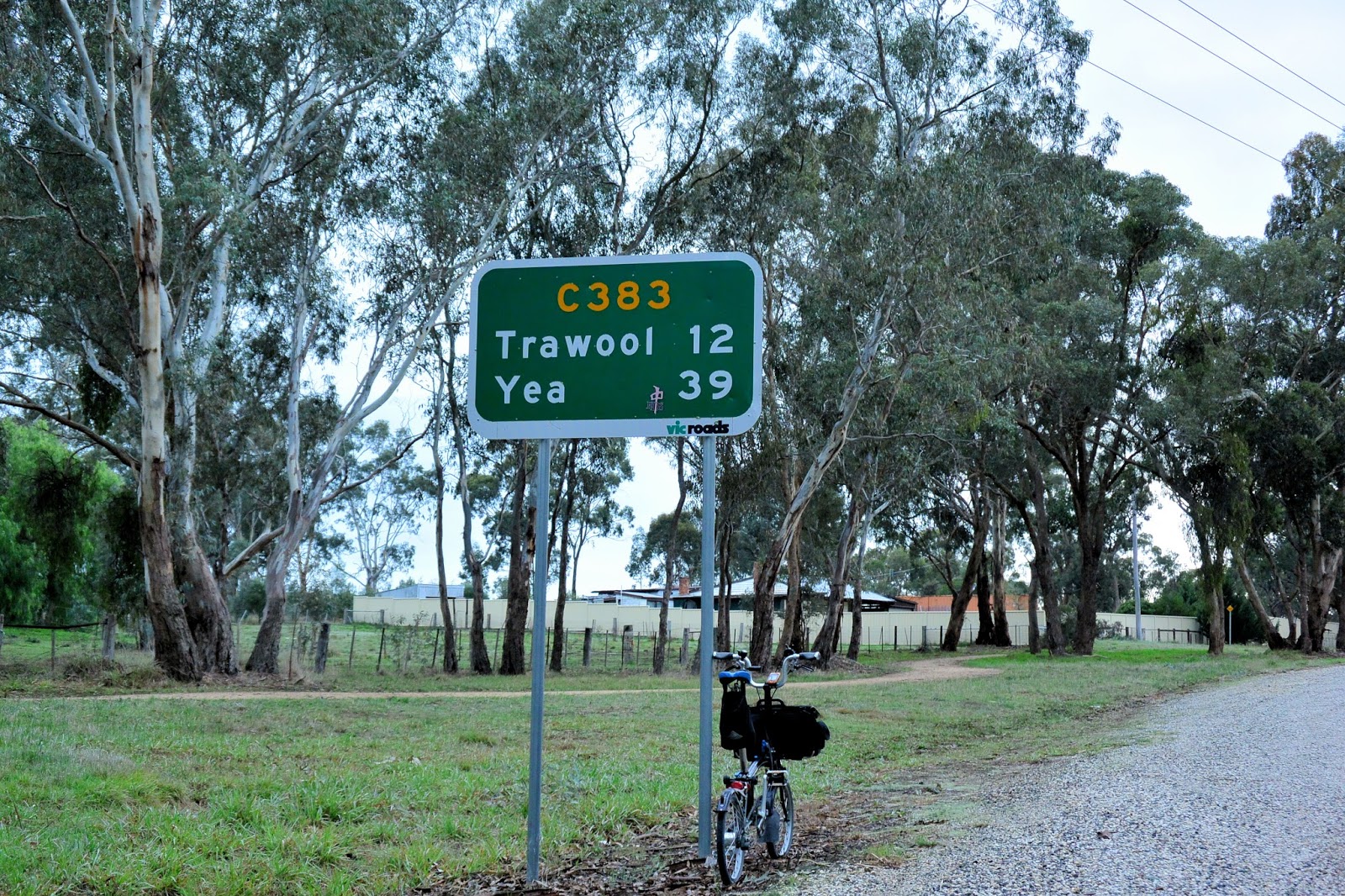
The bus brought both Brompton and me from Lilydale to Warburton via Warburton Highway.

Arrived in Warburton bus stop at 9:25 am. The hill climb ride started for more than 1000 meters ascending today.

It looked just after rain. Road surface was wet and water fell down the mountain.

I did not take a rest for the first 45 minutes to acquire about 500 meters of ascending from the inception. When I reached the mid point with an elevation of 700 meters above sea level, I took a first stop.

It was getting cold as I reached 800 meters above sea level.

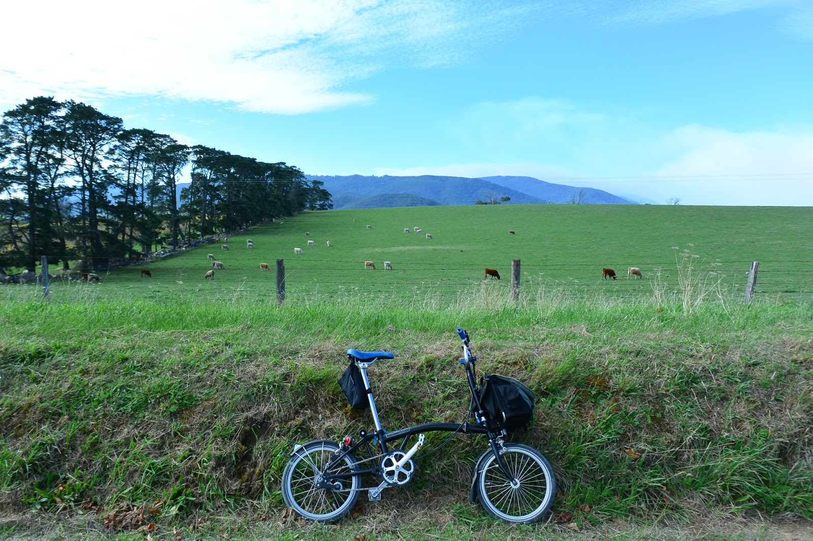
See. The clouds flew like a stream between Yarra ranges down there.

The last 3 kilo meters to go to the peak.

The slope of more than 10% continued at the last mile. Finally approaching the peak.

From Warburton to the peak, the distance is 17 km, acquired elevation is 1,106 meters and an average % of the slope is 6.7%. Ideal for the training. I am satisfied with today's achievement.

However, from the peak, any view over Melbourne was not expected today due to heavy fog. Temperature was about zero degree to freeze me a lot. I put on an additional warmer wears and a pair of gloves to prepare for a high speed downhill through icy air of the mountain. As winter comes, the peak will soon be covered with white snow.

On the way down to Warburton, suddenly sunshine came out. Another beauty.

What a wonderful view of Yarra Ranges it is! This panorama rewarded a tough ride today.

 Autumn tint embraced me and Brompton on the way back.

When Brompton and I were about to arrive at the Warburton bus stop, rain started again. I immediately took a bus ride to Lilydale, taking advantage of Brompton's portability.

It was a really good hill ride for Brompton today. I will come back with a pair of stud tyres when snow falls in the upper part of Mt Donna Buang.


Related Article:

[Brompton Hill Climb story]

The road to the summit of Mt. Dandenong
Brompton climbs in Victoria
Crossing Yanagisawa Pass to Sakeishi Hot Spring
Three Bromptons reached the Shibu Touge Pass of 2172 meter high
Go to the end of that valley: Kirizumi Hot Spring
Go over the ridge again: Tsuchiyu Pass
Spring has come. Let's go beyond the clouds!
Ubayu Hot Spring - An ultimate onsen

[Mountain trails story]


Sunday, May 22, 2016

Brompton climbs in Victoria

While I have spent a couple of months here in Melbourne, I have been looking for the best hill climb course for a Brompton ride. In the past my favorite hill climb routes were the Mt. Fuji Hill Climb course (Fuji Subaru Driveway) in Fuji Yoshida City (Yamanashi) and the Yabitsu Pass route in Hadano City (Kanagawa).

If you have been in Japan (Tokyo) and was a rider there, you might have participated in Mt. Fuji Hill Climb Race, the largest hill climb race in Japan with more than 8,500 participants. I loved the course and practiced several times the course before the race. It has a distance of 25 km and elevates by 1,270 meters towards 2,304 meters above sea level. Average 5.1% ascending. Very good!


Mt. Fuji Hill Climb Race (Click the photo to read.)

Maybe you also have heard the name of the Yabitsu Pass where any hill climber in Japan knows and frequently visits for his/her training. Some cyclists call Yabitsu as the holy site of hill climbers. The Yabitsu pass has an elevation of 761 meters but, if you start from Minoge where the very steep ascending begins and lasts to the end, the difference in elevation is about 450 meters to reach the pass while its distance is only 7.2 km. 6.25%. Wow.


Yabitsu, the best hill climb place (Click the photo to read.)

There is an emergent need of the hill climb training for me. I am planning to take a part in the Brompton World Championship 2016 on Saturday 30 July. I want to train my physical to improve my result in the race from last year's three digit place. 

BWC 2015 in London (I was a green guy in the center back. Click the photo.)

If it had been Tokyo, I would have visited the Yabitsu for training every weekend but now I need a replacement for the Yabitsu here in Australia. There are three conditions to be satisfied with for my Yabitsu replacement.

1. not too hard
2. not too far
3. public transportation (I do not like to drive back after a heavy hill climb.)

I am not at all an idiot to risk a heart attack during training. In addition, I am a Brompton rider. What I want is just a moderate hill which is adequate for a 2-speed or 3-speed modest bike to go with a short distance hopefully less than 20 km which does not affect my professional life during week days (my job is of course not a Brompton racer or an Onsen explorer). 

I avoid a long trip to the site. I like a half day return in case of training. During weekend I have many things to do, including a rail trail ride and nap.

Public transportation is essential for my hill ride. When I train myself, I tend to try my limit of capacity and will be too exhausted to drive back. It had better getting on the train and sleep toward Flinders Street Station or Southern Cross Station on my way back. 

After I started a thorough research to find the best place to go with Brompton, I shortlisted the following seven places which can be my Yabitsu in Australia.

1. Mount Buller (1,805 m)
2. Mount Donna Buang (1,250 m) 
3. Mount Macedon (1,001 m)
4. Mount Buninyong (719 m)
5. Mount Franklin (648 m)
6. Mount Dandenong (633 m)
7. Mount Diogenes (718 m) which is famous for "Hanging Rock"

This weekend, I climbed up the two most promising candidates among all; Mount Macedon and Mount Dandenong.


In Saturday afternoon, I went to the area of Yarra Ranges or Danddenong Ranges. When I got off the train at Boronia Station of Belgrave Line, time was already 3:30 pm because of cursed bus replacements between Richmond and Camberwell. Immediately I headed to Mount Dandenong, clicking my garmin to start here.

Gradually acquiring elevation.

Yarra Ranges. Still in the mid of the mountain highway.

Getting closer to the goal.

Arrived at Sassafras. Total ascend was 350 meters and distance 9 km. Average percentage of slope is 3.9% and maximum about 10%. Not so bad.


On Sunday, I departed Southern Cross Station for Mt. Macedon at 8:32 am.

When I arrived at Woodend Station of Bendigo Line, I looked over the goal, the peak of Mt. Macedon with an elevation of 1,001 meters above sea level, from the station. Let`s start.


There were a lot of riders already their jobs done though it was still in the morning.


I put my garmin on to time when the slope started at the foot of the mountain. The slope was not that tough.


It was already about 900 meters. Clouds were passing among the trees.

Getting closer to the peak!

Finally I arrived at the peak cafe to drink cafe latte. From the foot to the peak, a distance was 11 km and total ascending was 500 meters. Average percentage of slope was 4.5% and maximum around 12%. It's a good figure for a Brompton hill climb!

I may try another one next week but Mt. Macedon is possibly my Yabitsu in Australia!


Your references:

Brompton Hill Climb story

Friday, May 20, 2016

Brompton goes to the Great Victorian Rail Trail (the Goulburn Valley rail trail)

Last Saturday Brompton and I went out for a long ride to the Great Victorian Rail Trail which follows a trace of the old Goulburn Valley Railway track branching from Tallarook toward Mansfield via Yea.

Great Victorian Rail - Australia's Longest Rail Trail

The main northeast line from Melbourne reached Tallarook in November 1872. Ten years later, in 1882, a rail line was surveyed as far as Yea and the construction contract awarded. The route followed the curves and undulations of the Goulburn Valley, hugging the steep walls on the south side of the river. The terrain was not easy. In the first 11.2 kilometres to Trawool there were 17 curves and 68 changes of grade. The first train from Tallarook to Yea arrived on Tuesday 20th Nov 1883. Initially the return Tallarook to Yea train service was a daily Goods and Passenger train combined. The track speed was 60 km/hr. After nearly 15 years, work began on the Yea to Mansfield line on 27 April 1887. The first train steamed into Mansfield on 6th October 1891. In 1977, Tallarook to Mansfield (via Yea) passenger rail motor service terminated and soon all the services ended.


(source: Great Victorian Rail Trail Official Page http://www.greatvictorianrailtrail.com.au/


[Route Data]
Distance 85.9km (return)
Maximum difference in elevation 73m
Average % of slope ascent 2.1% descent 2%
Acquired elevation ascent 444m descent 430m

Early in the morning, Brompton and I were a part of the herd of bikes aboard the V-line trains from Southern Cross Station toward the places where are welcoming bike lovers. 

Arriving in Tallarook Station where the Great Victorian Rail Trail started.


Yea is about 40 km from the station. Mansfield, where the trail ends, is 135 km away.

The trail continues with a dozen of slopes of moderate ascending and descending.

Beautiful meadow!


The brompton encountered a beautiful, gentle horse and greeted to him.

Arriving Yea, a small but cozy town in the mid of the Goulburn Valley.

It already past 4 hours before reaching Yea. 


After a short lunch break at Yea, I carried on my trip for another half hour. However, it was almost time to turn back the way to Tallarook Station in order to catch 4:30 train. I finally decided to end up a today's trip before reaching Cheviot Tunnel situated between the towns of Yea and Molesworth. 


I need to come back here to go further to see a beautiful lake and to visit Mansfield before winter comes.


Updated: Finally I reached famous Cheviot Tunnel on May 17, 2017. A beautiful tunnel.


Related articles:

Wednesday, May 11, 2016

Flying over the Setouchi, the most beautiful inland sea - CYCLING SHIMANAMI 2016

Why don't you join this GREAT CYCLING EVENT "CYCLING SHIMANAMI 2016" held at Japan's most beautiful cycling route over the sea.

http://cycling-shimanami.jp/english/

1. Event: Setouchi Shimanami Kaido International Cycling Event "CYCLING Shinamani 2016"

2. Date:
 [Check-in] Saturday, October 29, 2016
 [Event] Sunday, October 30, 2016

3. Courses: There are five courses to be offered.

Course nameDistanceCapacityEntry Fee


ACOMPLETE
SHIMANAMI 150
Imabari ~ Onomichi
<Roundtrip>
about
150 km
500
Participants
13,000 yen


BONOMICHI 70
Imabari ~ Onomichi
〈One way〉
about
70 km
1000
Participants
11,000 yen


CYUMESHIMA 70
Imabari ~ Kamijima
〈Roundtrip〉
about
70 km
300
Participants
11,000 yen


DOMISHIMA 110
Imabari ~ Omishima
〈Roundtrip〉
about
110 km
1000
Participants
10,000 yen


EOSHIMA 40
Imabari ~ Oshima
〈Roundtrip〉
about
40km
700
Participants
4,000 yen


click to enlarge
*Entry fee includes handling and entry fee and is non-cancellable and non-refundable.
*Applicants ABCD are required to complete the course within the estimated time. Please be sure to include break times for each aid station.
*Applicants E are required to apply for a bicycle type. Please refer to the guidelines from the Official Home Page.

4. Registration Period:
From noon Monday, May 9 until 11:59 p.m. Sunday, May 22
*A second round of registrations may occur in mid-June.

5. Application Procedure:
Online registration only. Register via the official website. Results of the lottery will be sent via email in mid-June. Successful applications must make the payment (entry and handling fee) by the specified due date.

6. Capacity: 3,500 people

7. Remarks:

(1) The Shimanami Kaido, often praised as “Holy Land of Cyclists” amongst Japanese cyclists, was selected by CNN as one of the world`s seven most incredible bike routes and also received one star by the Michelin Travel Guide. 

(2) You will enjoy the superb scenery of the Seto Archipelago and its famous tide streams and whirlpools from huge and beautiful bridges which Japan's building technology was poured into. 


(3) The One and Only Cycling Event in Japan on an Expressway. Cyclists can enjoy the openness on the expressway, where usually only vehicles are allowed to run. All courses pass through the expressway including the longest bridge in Japan and tunnels which allow bikes to go without change in elevation.


For your reference, the followings are the movies from the air and on the road when it was held there two years ago. Of course I participated in with my Brompton!


(click to view the movie.)

Sunday, May 8, 2016

Brompton goes to Lilydale Warburton Rail Trail

Yesterday, a sunny day, Brompton and I went out for a long ride toward Warburton situated at about 72 km east of Melbourne. 


[data]
Distance 44.5km (Lilydale to Warburton and strolling around)
Max. difference in elevation 138m
Average % of slope total 0.1% ascent 2.1% descent 2%
Acquired elevation ascent 250m descent 214m

It was just an hour train trip to Lilyndale Station, a gate of the rail trail.

There were a lot of cyclists with their own bikes in the train.


The trail continued with its gravel surface which was good for a nature ride with Brompton. A lot of people enjoyed the trail ride.


There is a lovely carriage cafe on the mid of the trail.


I met some horse riders during my trail ride.

Woori Yallock Station. I took a short break here.


Finally I arrived at Warburton Station.

Autumn foliage in the town has contrasted its yellow with sky blue. 


Lunch time! Let's have fish and chips.

Then strolled around the town. There was a lovely trail just beside Upper Yarra River. Quiet and clean.


I wish to revisit and stay here for a Brompton ride to Lala Falls or up Mt Donna Buang. I might need a pair of stud tyres for Mt Donna Buang though....