Monday, June 8, 2015

Crossing Yanagisawa Pass to Sakeishi Hot Spring

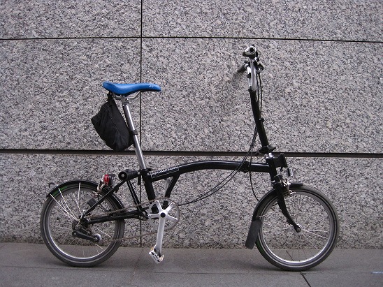
A day before yesterday Brompton and I went to Taba, a village of Tokyo's most important water source area, to go over Yanagisawa Pass, with an elevation of 1,472 meters, in order to dip myself into one of old and the best secluded hot springs in the foot of Mt. Daibosatsu at the end of the day.

[data]
total distance: 35.3 km (hillclimb part 16.8 km)
max. difference of elevation: 1,078 m
average %: total -0.6% ascend:6.2% descend:6.2%
acquired elevation ascend:896 m descend:1,114 m

https://www.google.com/maps/d/edit?authuser=0&authuser=0&hl=en&hl=en&mid=zVh_vanqLQwc.kDa1A4kcdmp0

Use JR Chuo Line from Shinjuku Station to Okutama Station. Do you imagine this is still a part of Tokyo.

When I arrived at Okutama Station, the last station, then changed to a bus bound for Taba, one of the hidden villages near Tokyo. A lot of people were all climbers waiting a bus to get to the trail gate of popular Mt. Kumotori, one of the hundred famous mountains in Japan.

I got off and unfolded my Brompton when the bus arrived in Taba, the last bus stop. The elevation was 627 meters here.

The route had about 16.8 kilo meter long and about 900 meter elevation to climb up to the pass.

Going along with an upriver stream of the Tama River.


Looking down the tunnel where I passed through 3 minutes ago.

Tokyo is already far beyond those mountains.

Any road even in very very country side is constructed with quality in Japan. Good for a Brompton ride but this is a part of fiscal problems of Japanese government.

Finally I was reaching the peak of the route. Then I took a rest to supply water and Udon noodle at the peak cafeteria.

Let's restart to go downhill.

Just in 10 minutes, I arrived at the entrance of Sakeishi Onsen Unposo. Sakeishi Onsen is located at the back door of Unpoji Buddist Temple which started its history about 1260 years ago. "Sakeishi" means a rip of the rock. The legend tells that a thunder hit the huge rock and suddenly hot spring started to come out from a chasm.
 http://unpoji.ko-shu.jp/

I checked in and hurried to the bath.

What a lovely open-air bath it is!

A long‐nosed goblin is traditionally a symbol of secret hot springs in Japan.

After a snap of kakeyu, I dived into this most secluded hot spring, gushing out from the crevice, in the rock bath under the big rock roof.


On the way to nearby JR Enzan Station, I dropped by at a cherry farm to purchase some boxes of fresh cherry and went back home by train.


Sunday, June 7, 2015

38T Chainring suitable for Brompton!

If you want to try a hill climb ride with your Brompton, you might adopt a 38T chainring.

I purchased Sugino 130J-PCD130 (38T) and changed from the original 44T. 38T is the minimum size for PCD130. You can realize that the diameter of a Brompton Spider crank is just the size of a 38T ring.

38T

44T

Brompton Titanium Bottom Bracket

Suitable for use with Brompton Bikes. Can be used in place of Brompton BB Cartridge JIS for Spider Crankset - 119mm. In addition to improving lotation, you can reduce BB weight by approx. 100g from the original.

It is made of Aerospace-grade Ti-6Al-4V (so-called 64 titanium) , meaning its composition of 6% alminum and 4% Vanadium.

Ti Parts Workshop Sealed Titanium Bottom Bracket w/ Japanese Bearings - tapered square 118.5 mm, JIS, 147 grams

Though TOKEN's titanium shaft BB is good, how about Ti Parts Workshop's?

This BB is design to offer a worry free direct replacement to the original BB. Your crank and pedaling system would be reminding the same with the extra smoothness and lightness begin added on. Aerospace grade Titanium, Ti-6AL-4V, had been used to produce the main axle by going through a lengthy CNC machining. The hollow titanium axle is strong and stiff enough to hold off a 120 Kg testing rider on some rough terrains with its weight limiting to 147 grams. It saves slightly 100 grams over the original Brompton square taper bottom bracket.
(Ti Parts Workshop official page)

Friday, June 5, 2015

Downhill of Norikura Skyline Highway - a road to the skyline

(continued from the previous article)

Let's go downhill of the skyline highway!

[data]
distance 21.4km
maximum difference of an elevation 1,482m
average % of inclination total -6.9% ascent 3.2% descent 7.4%
gained elevation ascent 16m descent 1,482 m
https://www.google.com/maps/d/edit?mid=zVh_vanqLQwc.krY8DdVoYMGI

Brompton and I started a downhill ride from Tatamidaira, with an elevation 2,702 meters, to the Hirayu Hot Spring with an elevation of 1,200 meters. It means approx. 1,500 meters of descending by Brompton.


There are only scrub thickets and likes because it is beyond forest limit.

Mount Hodaka (H) can be seen.

A long and winding road leads to the sky.

Descending from an alpine zone and arriving at subalpine zone with an elevation of approx. 2300 meters, there is a forest with tall trees.

At the point of an elevation 2032 meters. Kasagatake (2898 meters, K) in the center and Yarigatake(3180 meters, Y) in the right.

Arriving at Hirayu pass. The end of Norikura Skyline highway. Another road continues to Hirayu hot spring.

Let's continue downhill to Hirayu.

I would like to tell you the story of Norikura Skyline Highway. The road was completed in 1942 with 3.6m wide and total extension of 15km from the foot of the mountain. The purpose of the construction was for research and development of warplane engines. It's a history.

Brompton in the sky!

I went to Norikura Mount Skyline highway, the highest point of the paved vehicle road in Japan. In order to save natural environment and ecosystem, the road is restricted  except bicycles and permitted transit buses.

Let's see this scenary! The road looks being connected with blue sky. It is exactly "a road in the sky."

The top of "Devil Mountain", an elevation of 2764 meters.

The scenary in the back is like this. A beautiful sea of clouds. I got it! Let's go to that saddle of the ridge and take nice pictures of Brompton with a backdrop of that sea of the clouds!

Brompton flying in the sky!

Then, starting an extreme downhill ride.

Next: Norikura Skyline Downhill Ride

Saturday, May 30, 2015

Mount Fuji

Brompton and I climbed Mount Fuji to get to the fifth step where is a goal of the Mt. Fuji Hillclimb Race held on June 14 (Sunday). Mt. Fuji is the highest mountain in Japan at 3,776.24 m (12,389 ft).

Mt. Fuji Hillclimb Race is the largest and most popular hill climb race in which 8,500 cyclists are going to participate to run on the famous Fuji Subaru Line Highway with a distance of 24 km and total elevation of 1,255 meters. The participants start at the gate of Fuji Subaru Line Highway and head for the upper part of Mt. Fuji to end up at an elevation of 2,305 meters.
http://www.fujihc.jp/english.html


In a Today's training I decided to cut both of distance and elevation into a half of the race. I went to the third step of mt. Fuji by bus and started from the third step instead of the gate of the Fuji Subaru Line.

[data]
route: from Mt. Fuji third step bus stop (1,709m) to Mt. Fji fifth step (2305m)
distance: 12.98 km
difference in elevation: 596 meters
average inclination:  4.6%
average speed: 11.7km/h
https://www.google.com/maps/d/edit?authuser=0&authuser=0&hl=en&hl=en&mid=zVh_vanqLQwc.kHAnTXmDP6qU

A lot of riders also came here for training. They are supposed to run for the race.

Those beautiful ladies are also expected to join the race.

They must be participants!

Not a few riders have already reached the top and are going down the mountain at high speed. I still need some hundred meters to climb. I was gradually exhausted.

But what a fine day!

I am approaching to the goal. It is almost at 2250 meters in elevation here.

Because Mt. Fuji is a volcano, there are a lot of traces of land slides because volcanic rocks and soil are fragile.

Finally I arrived at the fifth step, the end of Fuji Subaru Highway. The elevation is about 2300 meters, two thirds of Mt. Fuji's total elevation. There are a lot of riders to take a rest after their hard runs.

Then, let's go down to have a lunch and take a bath at one of the secluded hot spring at the foot of mt. Fuji.

I arrived at Yoshinoike Onsen (a hot spring lodge) near Mount Fuji.

In the end of the day, relaxed and enjoyed in the hot spring!