Tuesday, October 13, 2015

Kamikochi - Great Old Route Via Tokugo Pass #2

Previous article:

Let's go to a wonderful mountain with your Brompton. Brompton and I  were on the way to trace the Grand Old Route to Kamikochi. Around 9 am we reached the Tokugo Pass at an elevation of 2,135 meters.


[Ride and Trekking Data]

Route: Kamikochi bus terminal(05:30am)~Myojin~Tokugo Pass~Iwanadome Lodge~Futamata~Simashima~Shin-Shimashima Station (Kamikochi Grand Old Route)
Distance: 33.5 km
Max. difference of elevation: 1,419 m
Average % of slope:  total: -2.3% ascent: 8.6% descent: 8%
Acquired elevation:  ascent: 726 m descent: 1,503 m

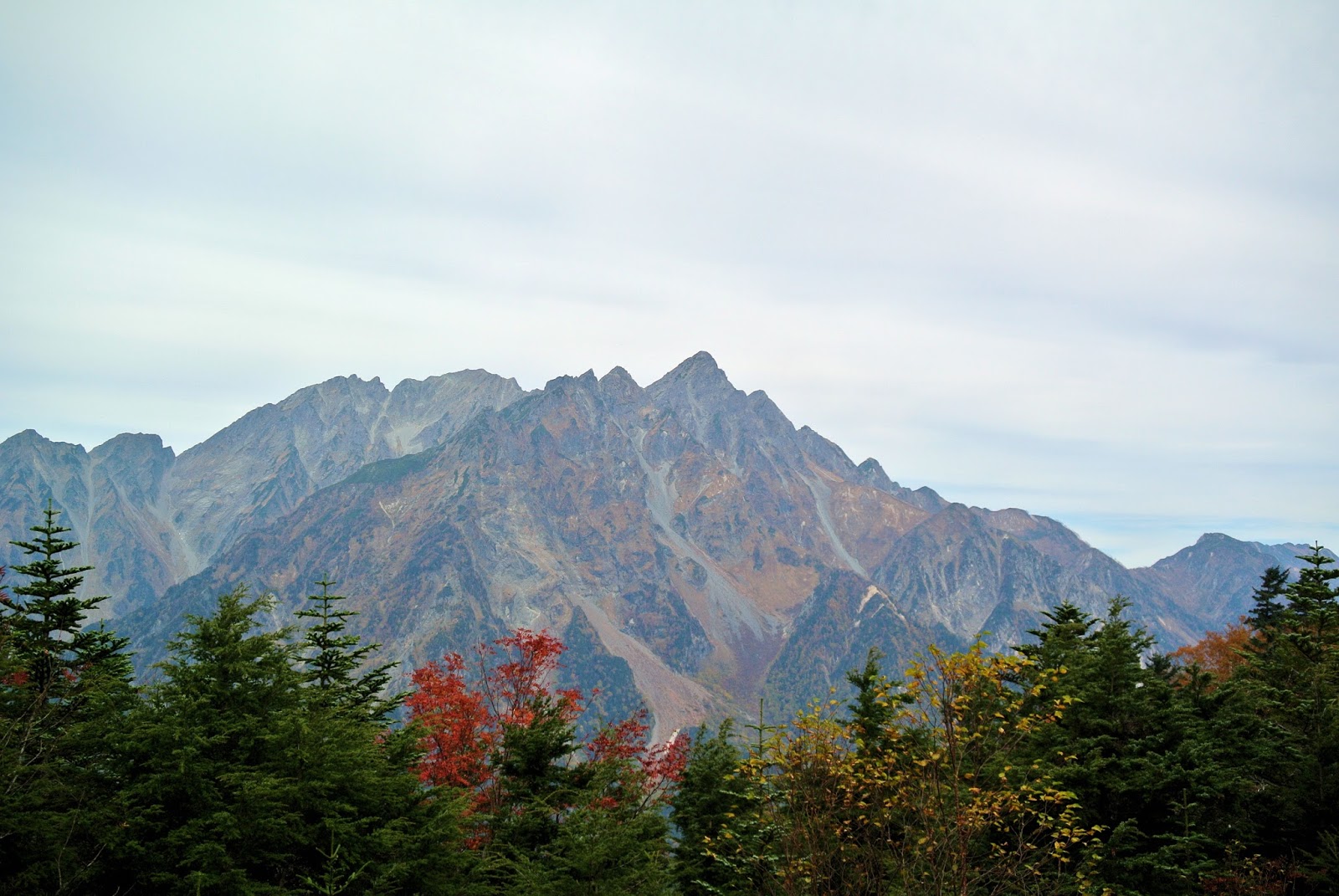
See this stunning view. It's Mt. Myojin, a part of the Hodaka Mountain Range. 
There was a historic mountain lodge "Tokugo Toge Goya" which was built in 1923. It is designated as an important National Cultural Properties.

I suddenly felt hunger. Shall I have an early lunch here.

It was cold on that day. I ordered a bowl of Udon, a Japanese popular noodle soup. It's hot and tasty. 


After about an hour rest in the hut, I  restarted.

From the location the south Japan Alps can be seen far beyond autumn-colored mountain forest. 

After 30 minutes of descending, there was a water supply point. The point is called Chikaramizu, meaning Power Water. The spring water is famous for its wonderful taste.

Continuing trekking. After 11 am I often met hikers and climbers ascending toward the pass. It is supposed that they had come from Shimashima, 16 km away. 

I was impressed with gorgeous autumn tints with red, yellow and fresh green in the valley.


(to be continued to #3)

Sunday, October 11, 2015

Kamikochi - Great Old Route Via Tokugo Pass #1

Let's go to mountains with your Brompton. Yesterday Brompton and I  traced the Grand Old Route to Kamikochi.


[Ride and Trekking Data]
Route: Kamikochi bus terminal(05:30am)~Myojin~Tokugo Pass~Iwanadome Lodge~Futamata~Simashima~Shin-Shimashima Station (Kamikochi Grand Old Route)
Distance: 33.5 km
Max. difference of elevation: 1,419 m
Average % of slope:  total: -2.3% ascent: 8.6% descent: 8%
Acquired elevation:  ascent: 726 m descent: 1,503 m


As you may remember that I went to Kamikochi to watch the best autumn tints in Karasawa last week. This time I brought my Brompton there to climb and traverse the great old trail to Kamikochi. The trail was only the route from outside to Kamikochi for more than several hundred years and the famous figures, such as Ryunosuke Akutagawa and Walter Weston, used to follow the route.

Arriving at Kamikochi very early in the morning. I found that several hundreds of people were about to depart for the mountains.


In order to reach Tokugo Pass, Brompton and I needed to go to Myojin where the old grand trail to Shimashima via Tokugo Pass started. As you do not know, due to the bike-offlimit rule in Kamikochi, I have to pull the bike instead of to ride before arriving the entrance of the trail. 

As I did not like to have climbers and hikers being surprised with my bike, I crossed the Azusa river over the Kappa Bridge to use another trail to Myojin on the north bank. This route was less popular and I expected less people. It was true that there was a quiet Kamikochi environment early in the morning. It was completely another world from the main route to Tokusawa in the south bank.

Autumn leaves have already turned into red and yellow.

Mount Myojin in morning glow.

There were dead whitened trees in the pond of very clear water with backdrops of high mountains. It was really a perfect landscape of Kamikochi.

Prayed for today's safety at the Hodaka Shrine.

Then crossing Myojin Bridge to reach the entrance of the trail leading to the Tokugo pass and Shimashima.

I reached out the crossroad to both Tokusawa/Yokoo and Tokugo Pass/Shimashima. As it was the first day of three consecutive holidays of October in Japan, so many mountain climbers and hikers were walking with big rucksacks toward Tokusawa/Yokoo to head to the famous mountains such as Mt. Yari and Mt. Hodaka. Today Brompton and I directed to the Tokugo Pass for Shimashima. I started to ride from here.

The slope was getting steeper and steeper. On the mid way, I gave up to continue a ride and got off to pull the bike.

In the midst of climbing I enjoyed a beautiful contrast between rocky Hodaka Moutain range and autumn tints.

There was a water supply point before the pass. The spring water is cold, clear and very tasty.

800 meters left.

Brompton and I continued to progress toward the pass.

200 meters left to the first destination.

We arrived at Tokugo Pass around 9 am.

(to be continued to #2)

Sunday, October 4, 2015

Kamikochi - You can watch the Best Autumn Tints Ever

Yesterday I went to the Karasawa Cirque Glacier near Kamikōchi to watch the best autumn tints in Japan. Karasawa is getting to be known as a place of wonderful autumn tints of blazing yellow and red backdropped by high mountains with their ridges and moraine.


[data]
distance (walk): 36.6 km
max. difference of an elevation: 831 meters
time: ascent 4 hours, descent 3 and half hours


In the dawn Yesterday , I arrived in Kamikōchi by bus. Kamikōchi, a sanctuary in the heart of the Japan Alps, is the place where mountain lovers must go. Karasawa, the destination, is 15 km away and requires to climb by more than 800 meters.

I did not bring my Brompton on that day. Why? It's because the trail from Kamikochi (kappabashi) to Karasawa is bike off-limit. However, I wanted a day-return trip as usual. The last outbound bus from Kamikochi departs 5 pm. It had better come back here by 15:15 in order to catch an earlier bus connecting to the last express train bound for Tokyo. Thus, I needed to run instead of walk in a part of the trail to reduce the time (not all the way). 

This is the famous Hodaka mountain range. I planed to go to the back of that mountains. There is Karasawa Cirque, a today's destination. 

I started to walk along Azusa River in dawn. Karasawa is one of the most upper streams of Azusa 
river so what I needed was just to walk along the river. I went on 12km of the trail via Myojin, Tokusawa, Yoko-o and then climb up to Karasawa.

I reached Yoko-o Lodge after 2 hours of run and walk. The relatively flat trail ends here. After crossing the bridge, a hard mountain path was awaiting ahead.

Here is the bridge in the mid between Karasawa and Yoko-o.

There is Hontani-Bashi, a suspension bridge.

The steep mountain trail started from the other side of the bridge.

After three hours, suddenly a panorama of the mountain valley appeared. What a beautiful view with autumn colors! The Karasawa Hütte is located to the end of the valley.

When I climbed up another hundred meters of elevation to reach the edge of the moraine, I looked back over my way to see this wonderful scenery.

I am reaching the Hütte.

I arrived at 9:40 am after 4-hour trekking. So tired. Let's have an early lunch.

I ordered beef curry rice and Oden which The Karasawa Hütte is famous for. You can even order a mug of draft beer thanks to daily transportation by helicopter.


The Karasawa Hütte has a panoramic space on the roof. There are tables and chairs for several dozens of people to enjoy lunch and drink, watching the following beautiful landscape.


The view from the roof is stunning!

Let's drink a bottle of water.

Autumn tint lasts very short in high mountains. Fortunately I was able to encounter the best autumn-colored mountains with blue sky in the Japan Alps.


Let's go to Karasawa Cirque to feel the variety of seasons in Japan if you have a chance to visit Kamikōchi.

Related article:
http://bromptonwharton.blogspot.jp/2014/04/kamikochi.html
http://www.kamikochi.or.jp/english/areamap/