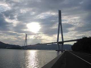
You can meet wonderful scenary you've never seen on the road.
Route: Sunrise Itoyama (hotel)→ Oshima Island (via Miyakubo path)→ Hakata Island → Omishima Island → Ikuchijima Island→ Innoshima Island→ Ikuchijima Island → Omisihma Island Bus Stop
Distance: 84km
Maximum difference of an elevation: 143m
Average % of inclination: total-0.1% ascent3% descent2.9%
Gained elevation: ascent408m descent478m
https://www.google.com/maps/d/edit?mid=zVh_vanqLQwc.kfOs2kKijcco
Kurushima Strait Bridge(length 4105m)
The bridge connects Oshima Island and Shikoku.
Ship Builder in Oshima.
Observing Tomari Village in Oshima Island.
An arch of Omishima Bridge watching from Taura Pass at Oshima Island.
Hakata Bridge (length 325m)
Oshima Bridge (suspension bridge, length 840m)
Omishima Bridge (Arch Bridge, length 328m)

Koune Bridge connecting Ikuchijima and Koune Island. Length 205m.
Tatara Bridge (Cable-stayed bridge, length 1,480m)
The longest cable-stayed bridge in Japan and the fifth in the world.
Ikuchi Bridge (Cable-stayed bridge, length 790m)
It is connecting Innoshima and Ikuchijima.


No comments:
Post a Comment